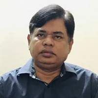
Director
Message from Director
Professor Dr. M. Nazrul Islam is a distinguished scholar and a senior professor with a rich academic and professional background in physical geography, specializing in fluvial-geomorphological and environmental sciences. He currently serves as the Director of the Institute of Remote Sensing and GIS at Jahangirnagar University and carries nearly 35 years of experience in teaching, r... Read More
About Institute of Remote Sensing and GIS
Contact Information
Phone: +8801730695998
Email: irsgis@juniv.edu
Academic Programs
- ২০২৩-২৪ শিক্ষাবর্ষের ইনস্টিটিউট অব রিমোট সেনসিং এন্ড জিআইএস-এর স্নাতকোত্তর (নিয়মিত) শ্রেণিতে ভর্তি পরীক্ষা সংক্রান্ত বিজ্ঞপ্তি
- Master of Science (MSc) in Remote Sensing and GIS for Session: 2022-23
- Master of Science (MSc) in Remote Sensing and GIS for Session: 2019-20
- 5th Certificate training course on Remote Sensing (RS), Geographic Information System (GIS), Global Navigation Satellite System (GNSS) and Drone Technology (3rd February -7th February 2018)
- Training program for Professionals on Remote Sensing (RS) and Geographic Information System (GIS) (30th November -15th December 2018)
- Click Here to View All
Research
- Click here to view our journal
- Projecting Climate Trends of Southwest Coastal Bangladesh under Global Climate Scenarios
- Impact of Land Use Land Cover Changes on Land Surface Temperature in Jessore District of Bangladesh: A Remote Sensing Approach
- Shoreline Change Detection of Nizam Island, Bangladesh (1997–2022) Using GIS and Remote Sensing Techniques
- Navigating Healthcare Systems Challenges Amidst Climate Change Impacts in Coastal Bangladesh
- Chapter 50 - Modeling the health impacts of climate change on people with disabilities: A complex adaptive systems perspective
- Click Here to View All
-
Admission Advertisement: Master of Science (MSc) in Remote Sensing and GIS
Jul 14, 2026 -
[Date Extended] Call for Papers : Jahangirnagar University Journal of Geospatial Sciences
Feb 02, 2026 -
Call for Papers : Jahangirnagar University Journal of Geospatial Sciences
Dec 11, 2025 -
২০২৫-২০২৬ শিক্ষাবর্ষে ইনস্টিটিউট অব রিমোট সেনসিং এন্ড জিআইএস-এ স্নাতকোত্তর (নিয়মিত) শ্রেণিতে ভর্তির মেধা তালিকা
Aug 13, 2025 -
Admission Advertisement Regular Masters Program (Academic Session: 2025-2026)
Jul 05, 2025
-
কানাডার বিশ্ববিদ্যালয়ের রিসার্চ ফেলো হলেন জাবি অধ্যাপক
Nov 05, 2023 -
Workshop on Remote Sensing and GIS held at JU
Aug 01, 2023 -
‘বিশ্ববিদ্যালয় স্থাপনের আগে শিক্ষার্থীদের মানোন্নয়নে নজর দিতে হবে’
Aug 01, 2023 -
বিশ্ববিদ্যালয়গুলো বিশ্বমানের না হলে শিক্ষিত বেকার কমবে না: অধ্যাপক সাজ্জাদ
Aug 01, 2023 -
Workshop on Advanced Remote Sensing and GIS held at JU
Aug 01, 2023
Faculty Members

Dr. Sheikh Tawhidul Islam
Professor, Institute of Remote Sensing and GIS

Md. Munir Mahmud
Assistant Professor, Institute of Remote Sensing and GIS

Toma Rani Saha
Lecturer, Institute of Remote Sensing and GIS
View All Faculty Members
Institute of Remote Sensing and GIS have total 3 faculty members.